Table of Contents
Garden of Eden Summary
Garden of Eden Report
aaaaLocation, Shape, and Size
aaaaGeophysical History
aaaaaaaaFrom The Urantia Book
aaaaaaaaPlate Tectonics Research
aaaaaaaaMediterranean Sea Research
aaaaaaaaVolcanology Research
aaaaaaaaWater Drainage
Additional Notes and Research
Garden of Eden prologue
For a better understanding of cosmological and biological issues related to Adam and Eve, see the Topical Study: Genetic Introductions, Mutations, and Evolution: a Urantia Book perspective. The Urantia Book-based taxonomy section explains Adam and Eve’s relationship to the rest of humanity.
The short version is:
1,000,000 years ago: In Mesopotamia, progressive evolution led to the human genetic mutation. Differently sexed twins separated from their parent’s prehuman tribe and started the first human family—the “Andonites.”
500,000 years ago: In the Afghanistan region, progressive evolution led to another mutation. These dominant genes came from one set of parents and gave rise to six colored (“Sangik”) races. All of them were more intelligent than the Andonites. This triggered the arrival of a host of additional ministering spirits, some of whom took a material form. Based on agreement not biological limitations, they did not procreate. But they were allowed to eat from the Tree of Life, which kept their bodies from aging.
200,000 years ago: A rebellion by ministering spirits occurred (including some that had taken a physical form), giving rise to religious traditions about Lucifer. The disruptive cultural consequences for men and angels also brought about a compensating genetic development—the Nephilim, also called “the mighty men of old.” The Urantia Book refers to them as “Nodites.” Traditions about the gods coming down and mating with the daughters of men relates to this transition, the breaking of the agreement. Compared to the Andonite and Sangik races, the Nodites were more physically robust, intelligent, and spiritually inclined, notwithstanding the significant spiritual confusion and misdirection that occurred as a result of the faithless Lucifer rebellion. Their cultural center at the headwaters of the Persian Gulf became known as the Land of Nod.
37,000 years ago: A now sunken peninsula off the coast of Syria is the location of the Garden of Eden and the source for myths about Atlantis. Adam and Eve were ministering spirits in material form with an agreement to procreate. Once their family attained a population of one half million, Adam and Eve’s descendants were supposed to go out and genetically uplift the rest of the world on all levels—spiritual, mentally, and physically. But their mission was cut short because they grew impatient with the challenges of the Lucifer rebellion. This led to violations of restrictions on how to appropriately procreate, which led to their mortality—the Tree of Life would no longer sustain them.
Garden of Eden Summary
The submerged peninsula between Cyprus and Syria
The Urantia Book says the first Garden of Eden was located on a peninsula off the eastern shore of the Mediterranean Sea. Adam and Eve, coming from the spirit world, arrived here approximately 38,000 years ago to genetically improve humanity. This process is designed to bridge the gap between the material and spirit worlds. Some problems developed after one hundred years. As a consequence, they decided to move their family to an area between the Tigris and Euphrates Rivers. This is the location of the Garden of Eden identified in the Old Testament. Approximately 34,000 years ago, the entire peninsula sank into the Mediterranean basin.
The Urantia Book describes the first Garden of Eden as “a long narrow peninsula—almost an island—projecting westward from the eastern shores of the Mediterranean Sea” with “encircling mountains.” It provides details about the Garden of Eden’s unusual topography and water drainage onto the mainland. It was large enough for a population of one million inhabitants. Areas of science related to this report include bathymetric mapping, tectonic plate movement, and volcanic activity. Issues related to the Strait of Gibraltar and a Sicilian land bridge to Africa are also at play. Some of the parallels between Urantia Book statements and developing research are right on the surface. For instance, bathymetric mapping off the Syrian coast reveals the shape of a “long narrow” region with encircling mountains. Some of the support for Urantia Book statements requires submerging oneself in scientific research studies related to volcanology and other geologically dynamic aspects of the Mediterranean region.
The geological history of the Mediterranean Basin is complex and not fully understood. Three major and several minor active tectonic plates converge where the Garden of Eden is said to have been located. Efforts to understand the geological history of this area are ongoing. Consequently, this report remains a work-in-progress. See also: UBtheNEWS: Pangaea to Plate Tectonics Report.
Garden of Eden Report
Location, Shape, and Size
Six years after The Urantia Book was published, a 1961 Life Pictorial Atlas of the World reminded its readers that …
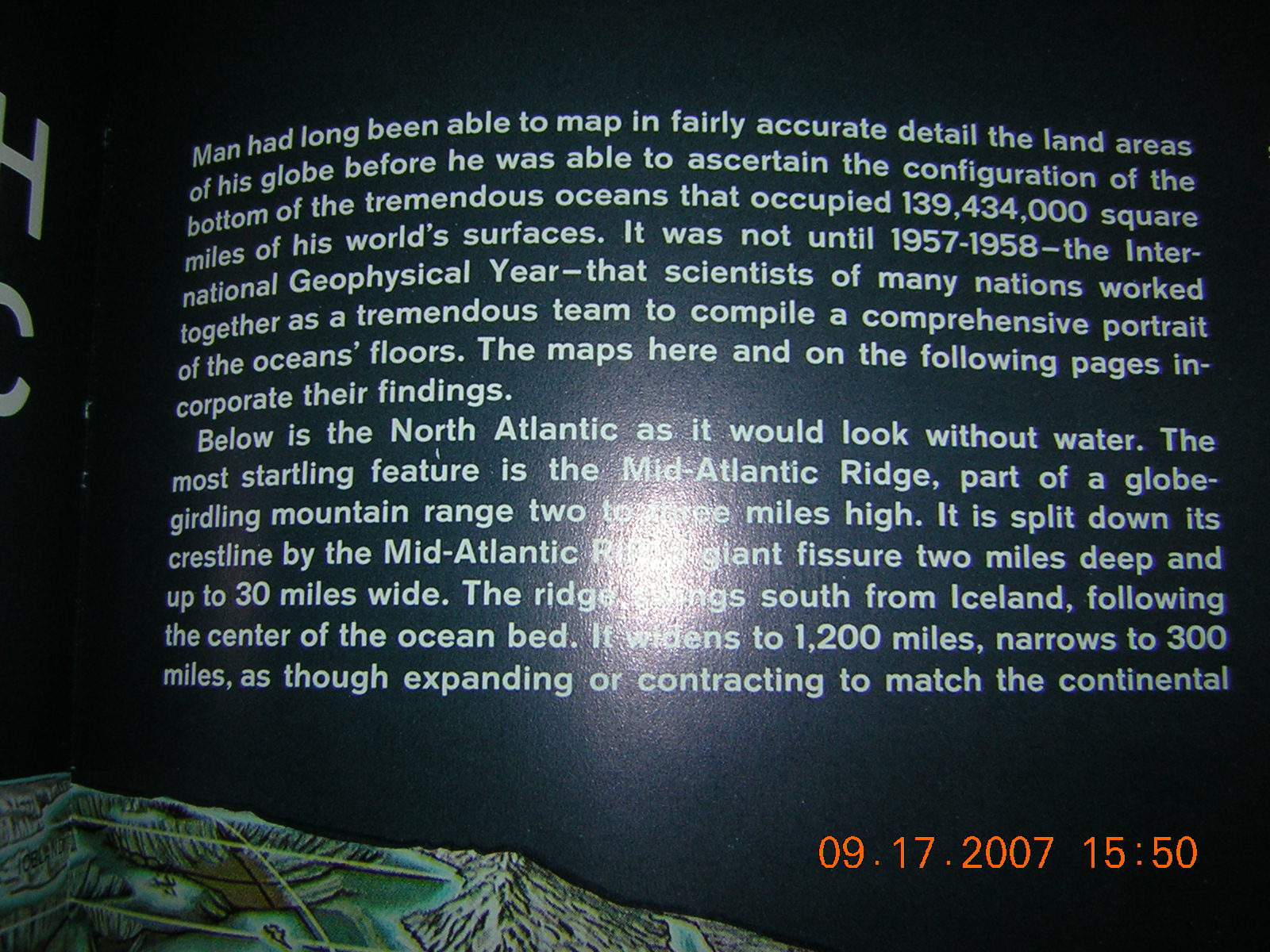
“Man had long been able to map in fairly accurate detail the land areas of his globe before he was able to ascertain the configuration of the bottom of the tremendous oceans that occupied 139,434,000 square miles of the his world’s surfaces. It was not until 1957-1958— the International Geophysical Year—that scientists of many nations worked together as a tremendous team to compile a comprehensive portrait of the oceans’ floors. The maps here and on the following pages incorporate their findings.” [See Appendix Notes: 1 to read the whole section from which that quote was taken.]
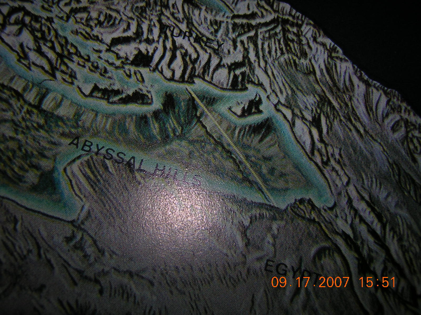
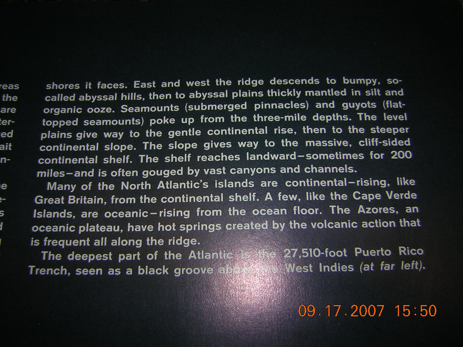
Image 2: 1961 Life Pictorial Atlas of the World.
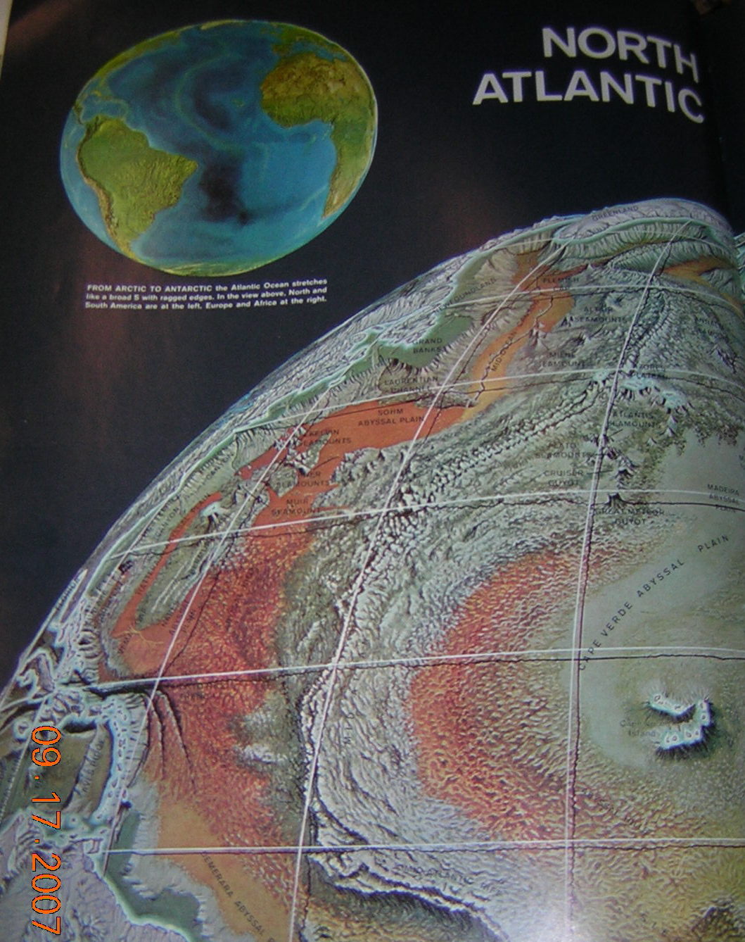
Image 1: 1961 Life Pictorial Atlas of the World.
Images 1 and 2 are photographs of the 1961 Life Pictorial Atlas of the World, showing about a quarter of the bathymetric globe with gridlines that was constructed and a close up of the eastern side of the Mediterranean Sea. (Note the shadow in Image 2 from the portion of gridline near Cyprus.) Such was the state of research and technology during this time period.
The proximity of The Urantia Book’s 1955 publication date to the 1961 Life Pictorial Atlas of the World and the 1957-1958 International Geophysical Year does not fully account for how much it was ahead of the science. A contract to create the plates for printing The Urantia Book was signed more than a decade before its was published. Any text refinements made between when the contract and publication were minor.
The description of the location, size, and shape of Garden of Eden, which advances in bathymetric mapping were destined to eventually support (or not), includes these details:
(73:3.1) … [A] long narrow peninsula — almost an island — projecting westward from the eastern shores of the Mediterranean Sea.
(73:3.3) This Mediterranean peninsula had a salubrious climate and an equable temperature; this stabilized weather was due to the encircling mountains and to the fact that this area was virtually an island in an inland sea. …
(73:3.4) The coast line of this land mass was considerably elevated, and the neck connecting with the mainland was only twenty-seven miles wide at the narrowest point. …
Image 5b.
(73:5.1) … The architectural plans for Eden provided homes and abundant land for one million human beings.
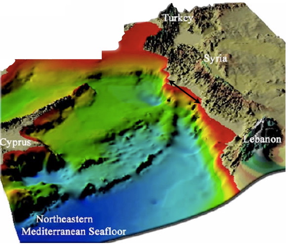
As Image 3 reveals, the availability of higher quality bathymetric mapping developed at a pace after the International Geophysical Year was declared. Images 4 and 5 demonstrate the degree of detail that emerged some three decades after publication of The Urantia Book. Note, of course, that the southern and central portion of the eastern Mediterranean basin is generally flat, while the area between the island of Cyprus and the Syrian coast has a topography that matches up with The Urantia Book’s description of a” long, narrow peninsula.” It even narrows as it gets to the shore.
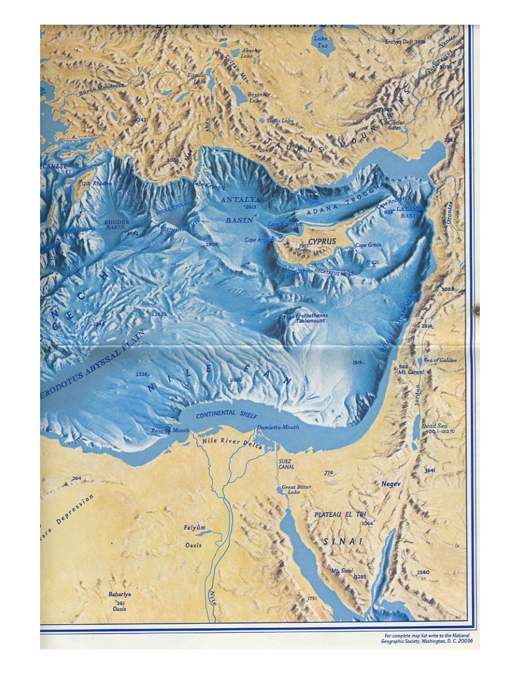
Image 3: circa 1975.
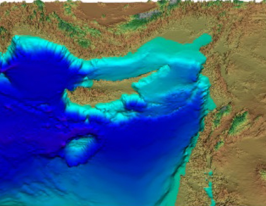
Image 4.
Image 5.
The Urantia Book does not specify how much land is needed for one million people. Rather, it comments about how such calculations need to take account of technological advances and existent balances between agricultural, industrial, and urban development. Nonetheless, the island of Cyprus is convenient for both size and population comparisons.
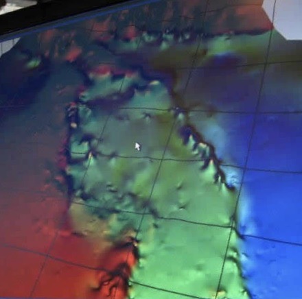
Image 5b.
The population for the entire island of Cyprus in 2018 was approximately 1,200,000 people. Using Images 4 and 5 for reference and assuming that the deep seafloor depression off the southeastern coast of Cyprus marks the western edge of what would have been the Garden of Eden, the length and width between and including the two seafloor ridges roughly corresponds to the size of Cyprus. In estimating a comparison, we should also note that Mount Olympus rises up to 6,404 feet. In contrast, the topography between Cyprus and Syria that matches up with The Urantia Book’s description of Garden of Eden shows narrower and lower ranges of “encircling mountains.” This comparative perspective with Cyprus in 2018 suggests that the area in question could have provided “abundant land for one million human beings,” especially when we consider that the food production arrangements on the Edenic peninsula are said to have been vegetarian.
(73:4.1) When … the biologic uplifters begin their sojourn on an evolutionary world, their place of abode is often called the Garden of Eden because it is characterized by the floral beauty and the botanic grandeur of Edentia, the constellation capital. Van well knew of these customs and accordingly provided that the entire peninsula be given over to the Garden. Pasturage and animal husbandry were projected for the adjoining mainland. Of animal life, only the birds and the various domesticated species were to be found in the park. Van’s instructions were that Eden was to be a garden, and only a garden. No animals were ever slaughtered within its precincts. All flesh eaten by the Garden workers throughout all the years of construction was brought in from the herds maintained under guard on the mainland.
(76:4.4) Adam and Eve and their first generation of children did not use the flesh of animals for food. They subsisted wholly upon “the fruits of the trees.” After the first generation all of the descendants of Adam began to partake of dairy products, but many of them continued to follow a nonflesh diet. Many of the southern tribes with whom they later united were also nonflesh eaters. Later on, most of these vegetarian tribes migrated to the east and survived as now admixed in the peoples of India.
Special thanks goes to Robert Sarmast for Image 5; the source is a 1989 Russian survey. The red color indicates where the shoreline starts. The areas on the ocean bottom depicted in turquoise and blue indicate a depth of 4,000 to 5,000 feet. The black double arrow along the Syrian shore shows a distance of twenty-seven miles, as mentioned in The Urantia Book. The horizontal to vertical ratio is 10:1. By looking at the sudden vertical drop off the southeast coast of Cyprus, we can see that this vertical distance on the page, representing about one mile in depth, is about two thirds the length of the black arrow depicting a distance of twenty-seven miles. This difference in scale exaggerates heights, allowing subtle topographical changes to become more noticeable.
Geophysical History
From The Urantia Book
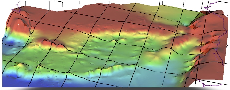
Image 5c
This is the information provided in The Urantia Book related to when and how the Edenic peninsula sank:
(74:0.1) ADAM AND EVE arrived on Urantia, from the year A.D. 1934, 37,848 years ago.
(73:7.1) [A]lmost four thousand years after Adam left the Garden … , in connection with the violent activity of the surrounding volcanoes and the submergence of the Sicilian land bridge to Africa, the eastern floor of the Mediterranean Sea sank, carrying down beneath the waters the whole of the Edenic peninsula. Concomitant with this vast submergence the coast line of the eastern Mediterranean was greatly elevated. And this was the end of the most beautiful natural creation that Urantia has ever harbored. The sinking was not sudden, several hundred years being required completely to submerge the entire peninsula.
(73:3.4) The coast line of this land mass was considerably elevated, and the neck connecting with the mainland was only twenty-seven miles wide at the narrowest point. The great river that watered the Garden came down from the higher lands of the peninsula and flowed east through the peninsular neck to the mainland and thence across the lowlands of Mesopotamia to the sea beyond. It was fed by four tributaries which took origin in the coastal hills of the Edenic peninsula, and these are the “four heads” of the river which “went out of Eden,” and which later became confused with the branches of the rivers surrounding the second garden.
(78:7.2) For thousands of years after the submergence of the first Eden the mountains about the eastern coast of the Mediterranean and those to the northwest and northeast of Mesopotamia continued to rise. This elevation of the highlands was greatly accelerated about 5000 B.C., and this, together with greatly increased snowfall on the northern mountains, caused unprecedented floods each spring throughout the Euphrates valley.
(61:3.7) 15,000,000 years ago the mountain regions of Eurasia were rising, and there was some volcanic activity throughout these regions, but nothing comparable to the lava flows of the Western Hemisphere. These unsettled conditions prevailed all over the world.https://ubannotated.com/main-menu/animated/topical-studies/astronomy/
(61:3.8) The Strait of Gibraltar closed, and Spain was connected with Africa by the old land bridge, but the Mediterranean flowed into the Atlantic through a narrow channel which extended across France, the mountain peaks and highlands appearing as islands above this ancient sea. Later on, these European seas began to withdraw. Still later, the Mediterranean was connected with the Indian Ocean, while at the close of this period the Suez region was elevated so that the Mediterranean became, for a time, an inland salt sea.
(61:4.2) 10,000,000 years ago began an age of widespread local land deposits on the lowlands of the continents, but most of these sedimentations were later removed. Much of Europe, at this time, was still under water, including parts of England, Belgium, and France, and the Mediterranean Sea covered much of northern Africa. …
(80:1.1) Before the last Andites were driven out of the Euphrates valley, many of their brethren had entered Europe as adventurers, teachers, traders, and warriors. During the earlier days of the violet race the Mediterranean trough was protected by the Gibraltar isthmus and the Sicilian land bridge. Some of man’s very early maritime commerce was established on these inland lakes, where blue men from the north and the Saharans from the south met Nodites and Adamites from the east.
(80:2.4) About the time of these climatic changes in Africa, England separated from the continent, and Denmark arose from the sea, while the isthmus of Gibraltar, protecting the western basin of the Mediterranean, gave way as the result of an earthquake, quickly raising this inland lake to the level of the Atlantic Ocean. Presently the Sicilian land bridge submerged, creating one sea of the Mediterranean and connecting it with the Atlantic Ocean. This cataclysm of nature flooded scores of human settlements and occasioned the greatest loss of life by flood in all the world’s history.
Plate Tectonics
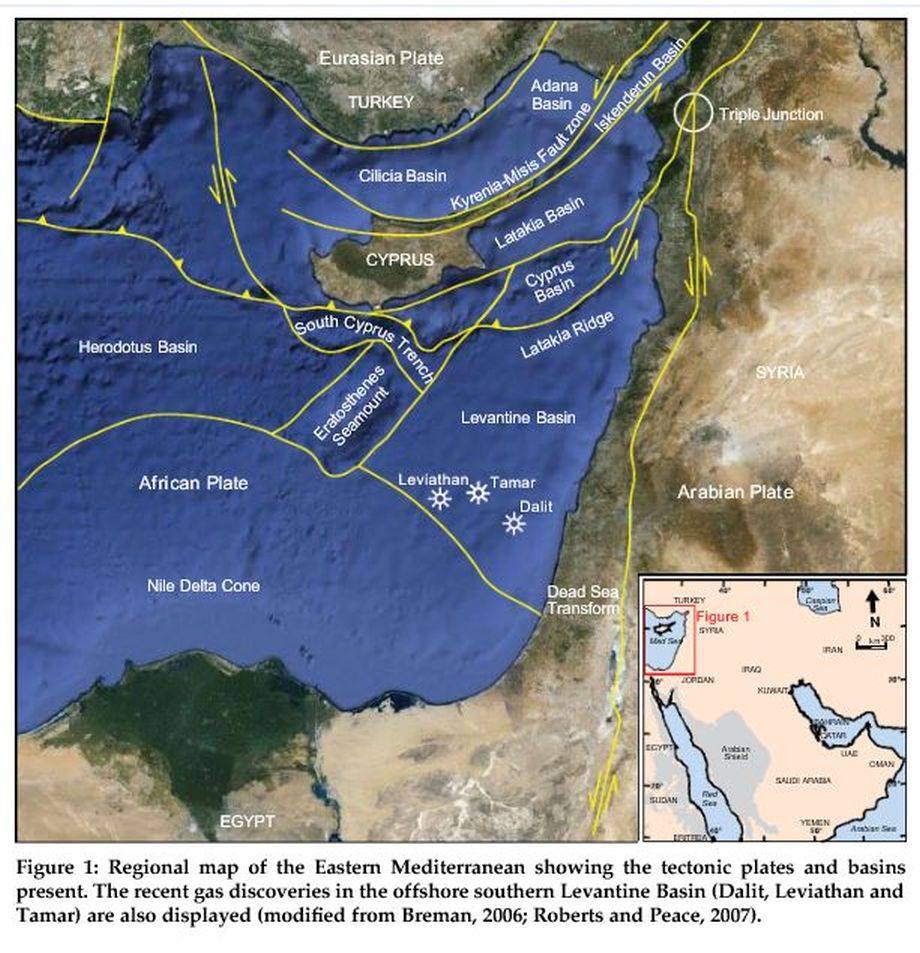
Image 7.
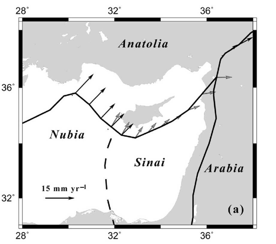
Image 6.
Tectonic plate maps were not available when The Urantia Book was published. In fact, another ten years would be needed to first develop the supporting theories, which could then be used to develop the mapping. The USC.edu website has a summary of the history of plate tectonics, which states:
“In the 1960’s a world-wide array of seismometers were installed to monitor nuclear testing, and these instruments revealed a startling geological phenomenon. It showed that earthquakes, volcanoes, and other active geologic features for the most part aligned along distinct belts around the world, and those belts defined the edges of tectonic plates.”
(See the Pangaea to Plate Tectonics Report for a fuller appreciation of how The Urantia Book’s statements about geophysics predated the broad scholarly support that now exists regarding Pangaea, continental drift, sea floor spreading, and plate tectonics.)
From the Mediterranean’s Strait of Gibraltar to its eastern shores, there are numerous minor fault lines and plates. The basin continues to be a geophysically active area. A 2006 article in Geophysics Journal International (GJI) explains some of the fundamental characteristics of this area, while also acknowledging that there is still more to learn.
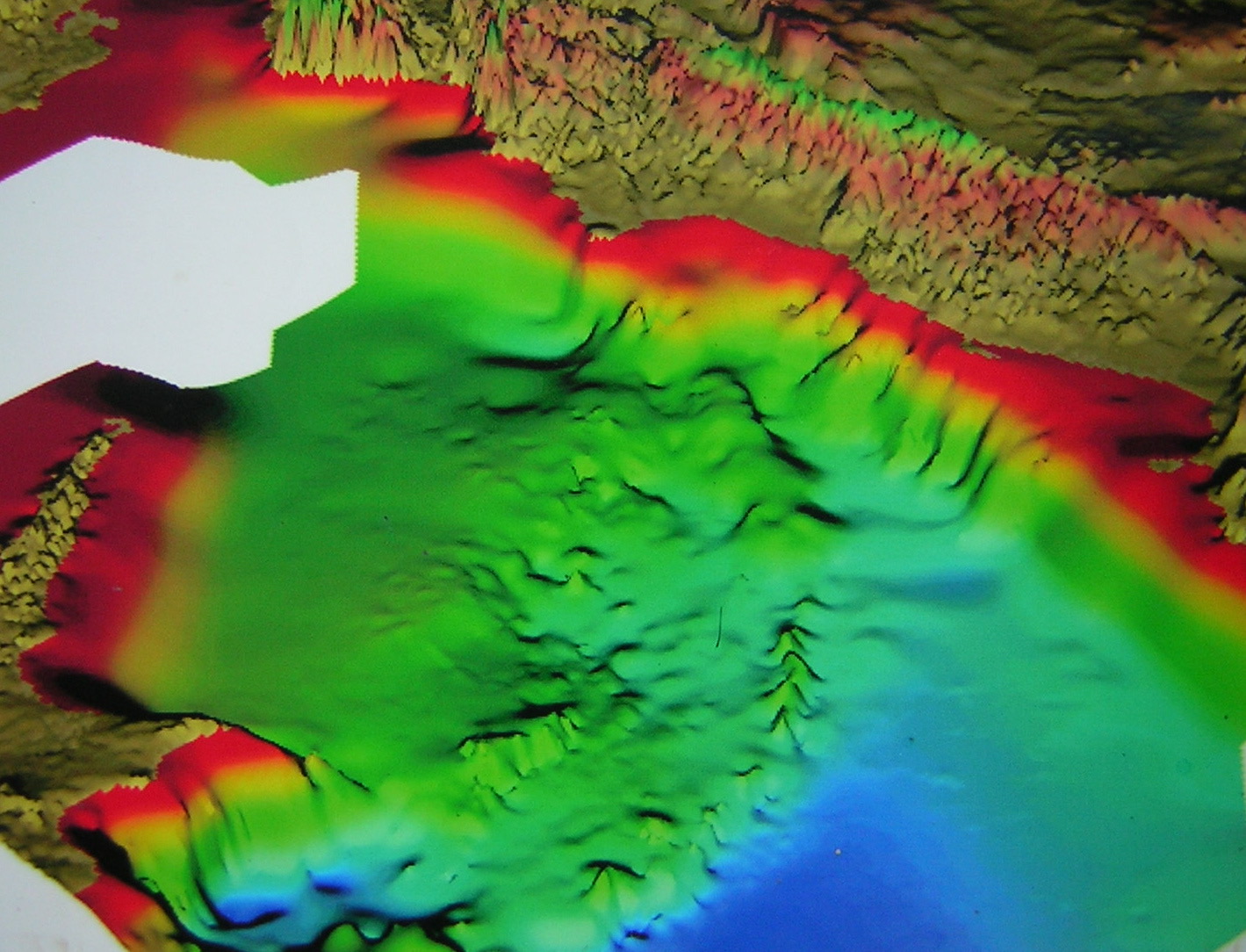
Image 8.
The region between Cyprus and Syria is marked by the convergence of three tectonic plates. According to the GJI article, “[M]cClusky et al. (2000) present in their maps two arcs, one north and the other south of Cyprus, suggesting that Cyprus behaves as an independent block. . .” This statement, regarding the independent behavior of Cyprus, along with the fact that Cyprus and Garden of Eden area are separated by the major Anatolia and Sinai plates, allows for the possibility that the region between Cyprus and Syria might have independently sank into the Mediterranean.
The GJI article also states that the “Cyprian Arc is subjected to subduction, collision and transcurrent tectonic processes.” Unlike the western side of the arc, where the Nubia plate primarily is experiencing a process of subduction (pushing under the Anatolia plate), the eastern side of the arc is experiencing a confluence of various tectonic plate forces. In all likelihood, these forces would tend to distort the topography of the peninsula, if it sank into the Mediterranean Sea. Also, note how the shoreline drops down immediately and there is a mountain range on land along the eastern coast of the Mediterranean.
Consider how the two elevated areas in Images 5 and 6 converge at the shore near the black arrow and then run roughly parallel to each other, as they project westward from the eastern shore of the Mediterranean. The convergence near the shore is consistent with The Urantia Book’s description of the neck narrowing to twenty-seven miles. Though the elevated areas converge to less than twenty-seven miles, the shoreline is noticeably more rugged than the smoother descending shoreline just to the south. Just to the north of the convergence there is a deeper drop compared with everything else to the north. Given the depth to the north, the more rugged terrain in the twenty-seven mile range near the shore, and the confluence of tectonic plate forces in this area, The Urantia Book’s description of the Eden peninsula and its fate, generally, appears consistent with topography revealed in Images 5 and 6.
Additionally, note how on the western side the elevated northern range breaks line and is further south as it approaches the southeastern tip of Cyprus. As well, for the most part, this northern ridge is less sharply defined than the southern range of hills. Based on the position of the line separating the tectonic plates in Image 8, it appears that the northern side of what would be the now submerged peninsula is situated more directly over the convergence of the plates. This can be appreciated by noticing that where the tectonic plate line breaks onto the shore is also the location of the more northern end of the double arrow seen in Images 5 and 6.
Volcanology Research
Consider how well the following studies and Wikipedia commentaries track with what is said in The Urantia Book:
(73:7.1) [A]lmost four thousand years after Adam left the Garden … , in connection with the violent activity of the surrounding volcanoes and the submergence of the Sicilian land bridge to Africa, the eastern floor of the Mediterranean Sea sank, carrying down beneath the waters the whole of the Edenic peninsula.
In February of 2017, EOS science news by AGU published an article about a caldera in Italy, titled “Deep Drilling Reveals Puzzling History of Campi Flegrei Caldera“:
“Two massive eruptions in the past caused the Campi Flegrei caldera to collapse: the Campanian Ignimbrite, which occurred 39,000 years ago, and the Neapolitan Yellow Tuff, which occurred 15,000 years ago. … The researchers took samples from different depths of the drill site and measured argon isotopes periodically so that they could estimate the age of various layers. The scientists combined the isotopic ages, fossil findings, and historical sea level records to assess the history of the volcano and how Campi Flegrei changed over time. The deeper layers between 250 and 501 meters do not contain fossils, meaning that the volcano was well above sea level more than 35,000 years ago. In the shallower layers, the scientists found microfossils that indicate an ocean environment, confirming that sometime between 17,000 and 35,000 years ago, the volcano collapsed.”
In September 1983, the Journal of Volcanology and Geothermal Research published an articled, titled “The phlegraean fields: Structural evolution, volcanic history and eruptive mechanisms“:
“The main event within the volcanic history of the Phlegraean Fields was the eruption, about 35,000 years ago, of a huge alkali trachytic ignimbrite (80 km3, dre) followed by caldera collapse. The pre-caldera activity (evidence from geothermal wells and surface outcrops) changed from submarine to subaerial shortly before the ignimbrite eruption. The caldera was subsequently invaded by the sea and became progressively filled with tuffites and subordinate submarine flows in its northern half.”
Wikipedia: Phlegraean Fields:
“The First Phlegraean Period. It is thought that the eruption of the Archiflegreo volcano occurred about 39,280 ± 110 years (older estimate ~37,000 years) ago, erupting about 200 km3 (48 cu mi) of magma (500 km3 (120 cu mi) bulk volume) to produce the Campanian Ignimbrite eruption. Its Volcanic Explosivity Index (VEI) was 7. “The dating of the Campanian Ignimbrite Eruption (CI) to ~37,000 calendar years B.P. draws attention to the coincidence of this volcanic catastrophe and the suite of coeval, Late Pleistocene biocultural changes that occurred within and outside the Mediterranean region. These included the Middle to Upper Paleolithic cultural transition and the replacement of Neanderthal populations by anatomically modern Homo sapiens, a subject of sustained debate. No less than 150 km3 of magma were extruded in this eruption (the CI eruption), traces of which can be detected in Greenland ice cores. As widespread discontinuities in archaeological sequences are observed at or after this eruption, a significant interference with ongoing human processes in Mediterranean Europe is hypothesized.” It is possible that these eruptions drove Neanderthals to extinction and cleared the way for modern humans to thrive in Europe and Asia. The area is characterised by banks of piperno [it] and pipernoid grey tuff at Camaldoli hill, as in the northern and western ridge of Mount Cumae; other referable deep products are those found at Monte di Procida, recognizable in the cliffs of its coast.
“The Second Phlegraean Period, between 35,000–10,500 years ago.
“This is characterized by the Neapolitan yellow tuff that is the remains of an immense underwater volcano, with a diameter of c. 15 kilometres (9.3 mi); Pozzuoli is at its center. Approximately 12,000 years ago the last major eruption occurred, forming a smaller caldera inside the main caldera, with its centre where the town of Pozzuoli lies today.”
Water Drainage Research
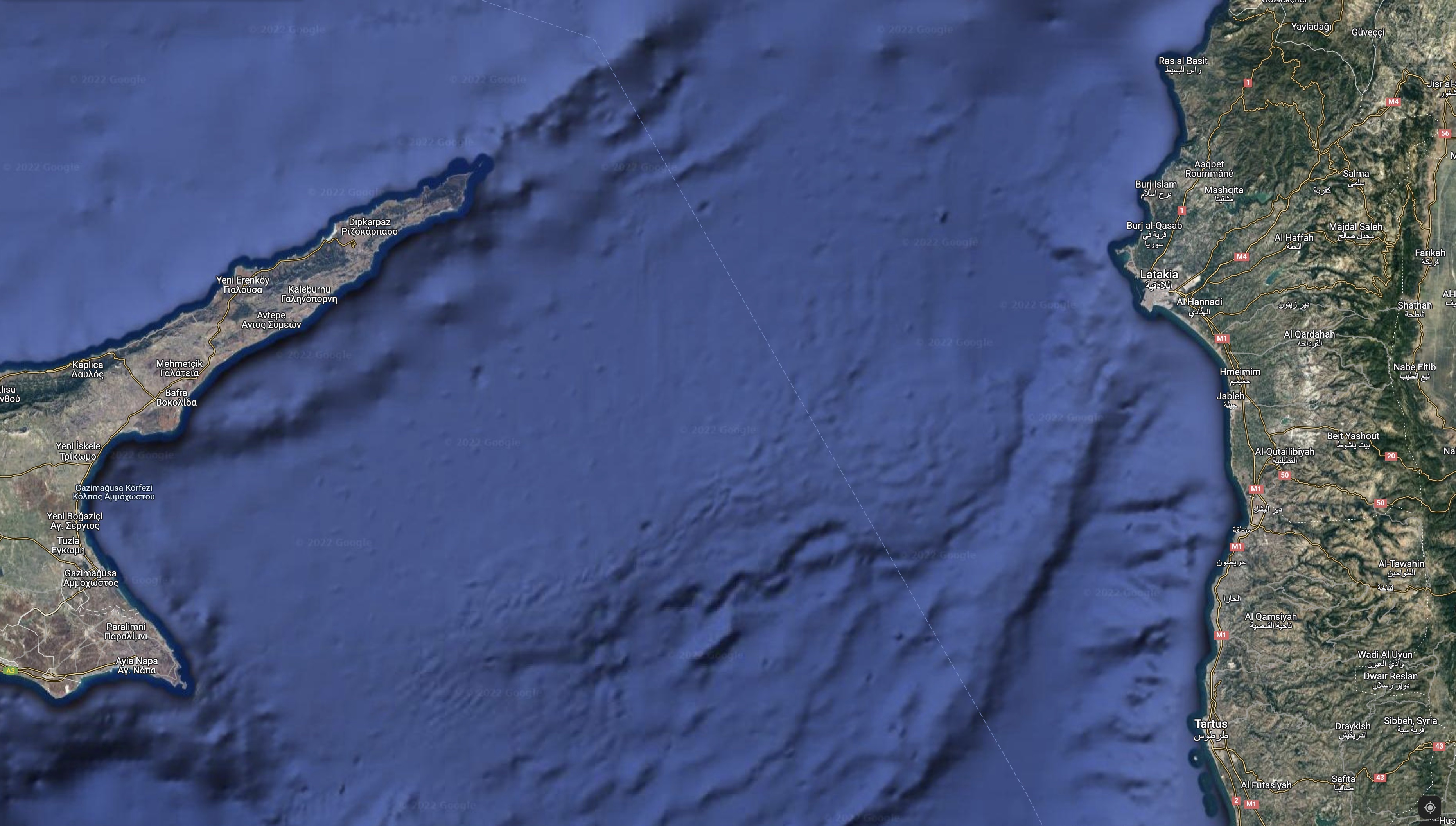
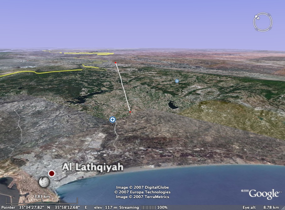
Image 10
The waters feeding the Garden of Eden and the geologic events impacting the topography are described in these two statements: “The great river that watered the Garden came down from the higher lands of the peninsula and flowed east through the peninsular neck to the mainland and thence across the lowlands of Mesopotamia to the sea beyond.” “Concomitant with this vast submergence the coast line of the eastern Mediterranean was greatly elevated.”
A depression in the mountains can be seen in Images 10 and 11. It runs aligned and parallel to the angle at which the now-submerged peninsula protrudes from the shore. Note also in Image 7 that the dip in the mountains is right where the Anatolia and Sinai plates meet.
 The eastern side of the Mediterranean continues to be a geophysically active. This invites speculate about how the area may have been affected 33,000 years ago by tectonic plate shifts, earthquake and volcanic activity, and flooding occasioned by a submergence of a land bridge from Sicily to Africa. These various forces challenge geophysicists when it comes to making definitive statements about the history of this area. In time, as geophysicists continue to develop their understanding of this area, even more corroborations may develop concerning The Urantia Book’s account of the Garden of Eden.
For now, at least, advances in sonar technology allow us to see a topography between Cyprus and Syria that is harmonious with all of The Urantia Book’s statements about the size, shape, and location of the Garden of Eden. Even the description of how water flowed off the peninsula can be correlated with the topography in this region. As well, tectonic plate theory, which was not developed until more than a decade after it was published, also lends support to its depiction of the fate of Eden.
Additional Notes and Research
Note 1:
Note 2:
Wikipedia: Phlegra (mythology).
Note 3:
Read a pdf of original UBtheNEWS presentation of the Garden of Eden Report.
Note 4:
Special thanks to Robert Sarmast for providing seafloor imagery and for efforts that inspired my own research into this topic. Robert Sarmast’s research, published in Discovery of Atlantis, led him to conclude that there is link between the mythology of Atlantis and the religious accounts related to Adam and Eve. He believes that the story of Atlantis developed because a new tribe of people came to occupy the architecturally developed Edenic peninsula after Adam, Eve, and their progeny abandoned this area. By the time the peninsula sank, some 4,000 years after Adam and Eve left, it had become disassociated with the civilization they had started. According to Sarmast’s research, the connection between Garden of Eden and Atlantis is that they had the same geographic location, but became associated with two different cultures. Sarmast attempted to find vestiges of human civilization at this location between Cyprus and Syria. More can be learned about his work by going to http://discoveryofatlantis.com/. Much thanks goes to him for allowing the UBtheNEWS project to use the images that were created in connection with his work.